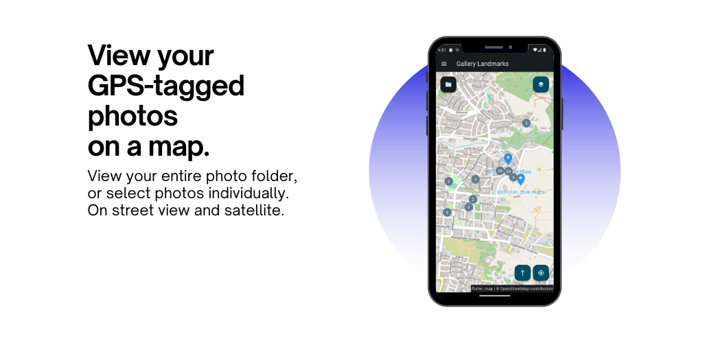
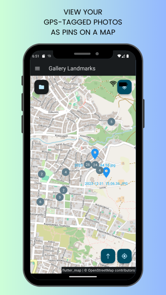
Gallery Landmarks is an Android app that displays your photos on a map.
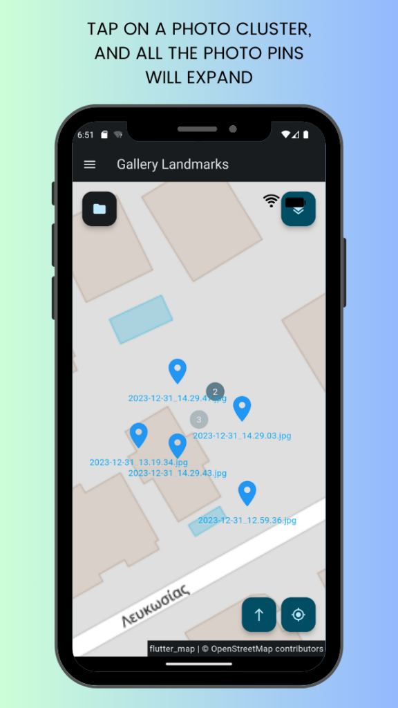
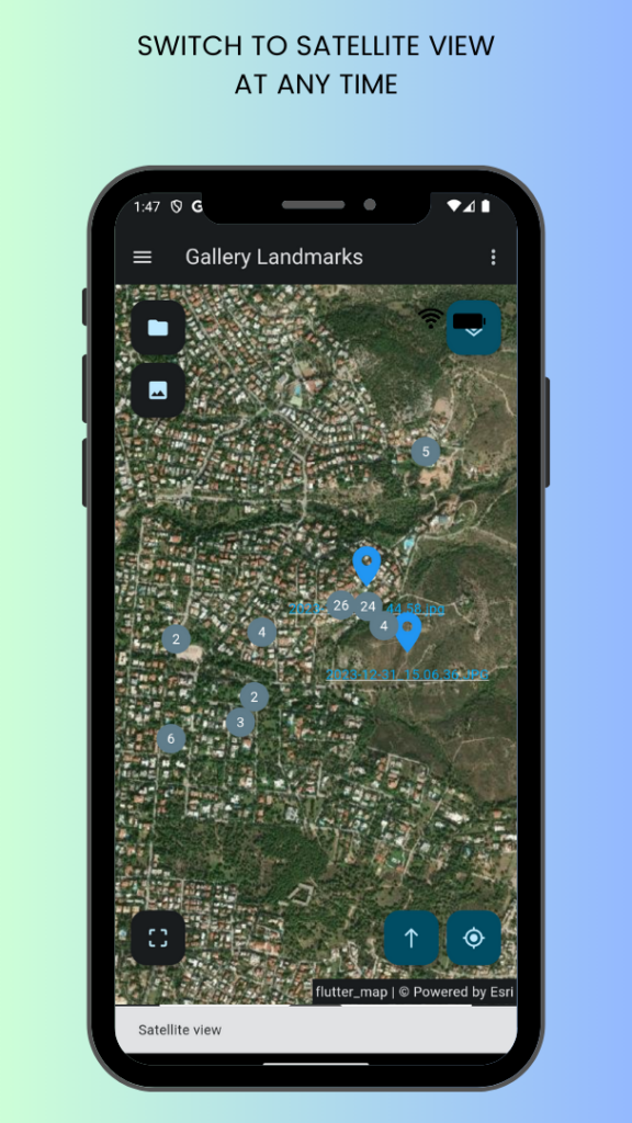
You can view all your GPS-tagged photos on a satellite or street-view map.
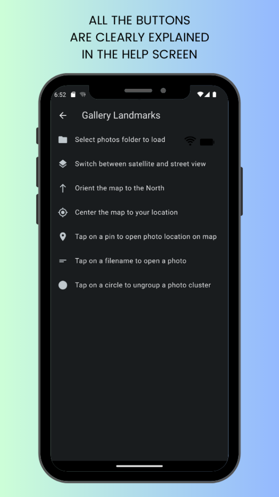
Tapping on a photo pin 📍 will open its location in another map app, such as Google Maps.
Tapping on a photo filename will open the photo itself in a photo viewer.
You can center the map to your current GPS location.
The app will remember your last viewed location when you restart it.
Screenshots
Changelog
1.2.3
- Add: Now respects night mode if set in Android Display settings.
- Improve: Now supports Android edge-to-edge feature.
1.2.2
- Fix: System buttons no longer hide bottom ad banner.
- Add: Enabled Privacy Sandbox APIs to comply with latest Google Mobile Ads SDK.
- Improve: UI performance.
1.2.1
- Fix: App no longer hangs in some cases right after successful in-app review rating.
1.2.0
- Add: Implemented in-app review with sentiment gating.
- Add: Feedback from unsatisfied users is now stored in Cloud Firestore for later inspection.
- Add: Urchin Tracking Modules on Play store links.
1.1.3
- Target Android 14 (API level 34) to comply with Play store policy.
1.1.2
- Fix: Banner ad now hidden when drawer opens to comply with AdMob policy.
1.1.1
- Add: When in the EEA, show option to modify/revoke targeted ads consent to comply with GDPR.
1.1.0
- Button to share/send all the photos in the current view.
- Button to share/send the app to a friend.
- Added snackbars.
1.0.0
- Button to ask user for a folder of photos to scan.
- Button to ask user for individual photos to load.
- Loads and displays on a map the locations of all GPS-tagged photos in the selected folder.
- Photos are loaded on a separate thread. While photos are loaded, the map is responsive.
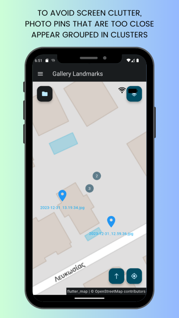
- Photos that are too close together are clustered together until the user zooms in.
- Tapping on a pin opens the location of the photo in another map app (e.g. Google Maps).
- Tapping the filename of a photo opens the photo in a photo viewer.
- Button to switch view between street map and aerial/satellite map.
- Button to orient the view to the north.
- Button to center the map to the current GPS location.
- Restarting the app takes the view to the last viewed location.
- Link in menu to find more apps like this from the same developer.
- Request user consent for admob to comply with GDPR.
- Help page explains how to use the app.
- About page for copyrights, license and disclaimers.